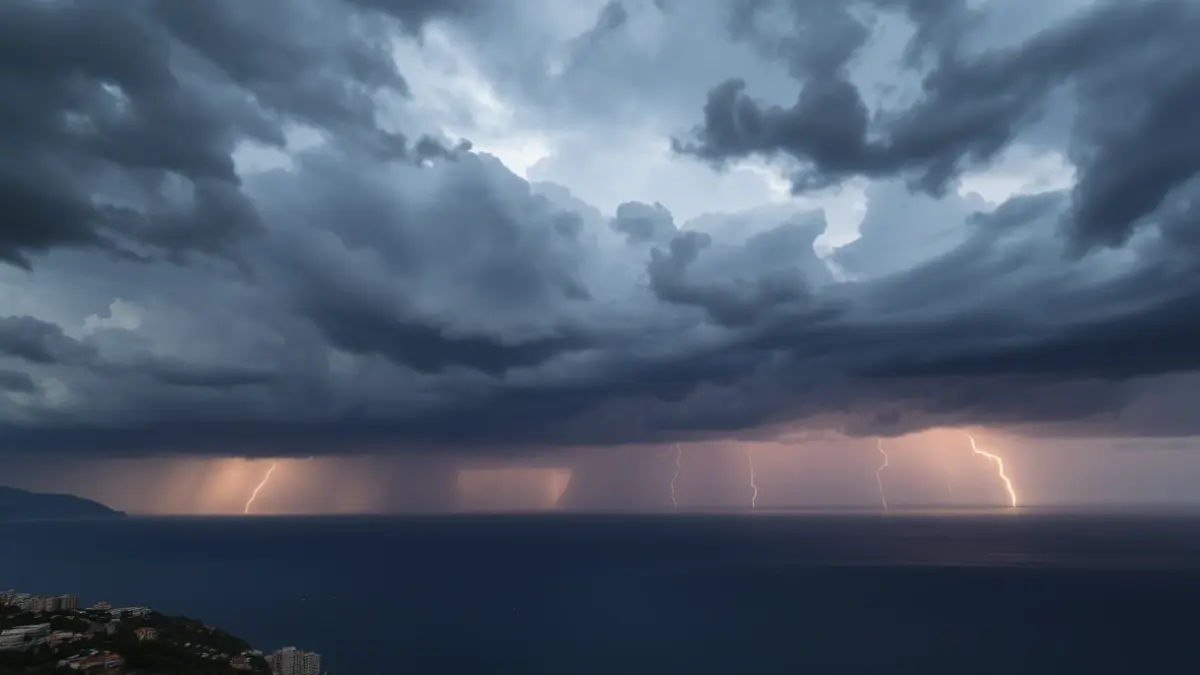
The weekend begins with a Saturday marked by the arrival of a band of precipitation that will sweep across the territory from south to north. Showers and storms entered the southern regions early in the morning and will advance throughout the day towards the center and north, mainly affecting the coast and pre-coastal areas during the central hours of the day.
The State Meteorological Agency has activated a yellow alert across the entire province of Alicante and along the entire Valencian and Castellón coasts. Rainfall is expected to reach up to 20 l/m² in one hour, and up to 30 l/m² on the southern coast of Valencia and northern Alicante. Thunderstorms may also be accompanied by hail. The alerts will remain active until 4:00 PM and until 6:00 PM in the case of Castellón.
Precipitation has already left significant records before the start of the weekend. In the city of Alicante, 25.8 l/m² have accumulated in the last day. Towards Saturday afternoon, rains will progressively concentrate in the north while clearings will begin to open in the Alicante regions. Additionally, new storms will arrive from Castilla towards the interior of Valencia. Precipitation will eventually subside late in the day and during the early hours of Sunday.
Temperatures will also drop slightly on Saturday, leading to a cooler environment than usual for the season. Maximums will range between 15 °C and 20 °C in many coastal areas, with locations such as Benidorm, Altea, or Sueca nearing 20 °C. In contrast, in the higher inland areas, such as Alt Maestrat, Racó d'Ademús, or Vall de Cofrents-Ayora, thermometers will not reach 10 °C.
The situation will change completely on Sunday, with a much more stable day, predominant sunshine, and a notable thermal rise. Maximums will reach 25 °C in many places, after a Saturday marked by instability and storms.